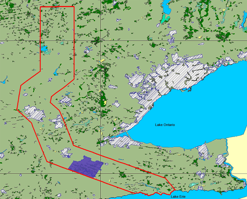
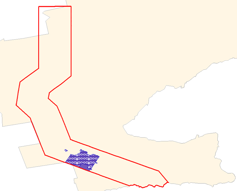
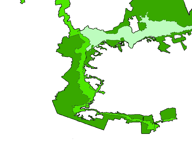
Contested Haudenosaunee Six Nations Confederacy Lands, Grand River

The area outlined in red represents the Haudenosaunee Confederacy's Grand River lands in 1784. According to the Haudenosaunee, much of this land was never lawfully surrendered and still belongs to them. According to the Canadian government, only the area in purple --about 5% of the total 1784 land holdings-- remains in Haudenosaunee hands. Users can roll over shapes on the map, or turn on additional map layers for more information.

Map use note: To turn layers on or off, click on the name of the layer in the right side bar. Generally, when multiple map layers are turned on, rollovers will only work for the activated layer that is closest to the bottom of the map.

Special Thanks To:

MAP HELP
Marcie Hill, Six Nations Lands and Resources
Phil Monture, President, Nativelands Ltd.
  TECHNICAL HELP
Jean Boulet, CUNY Graduate Center IT Instructor/ IT Consultant
Aaron Knoll, CUNY Gradute Center New Media Lab Web Developer
Map Layers
Click to turn layers on/off

Claims (with rollovers)

Potential Claims (with rollovers)

Township Boundaries (with rollovers)

Greater Golden Horseshoe

Greenbelt (with rollovers)

Designated Settlement 2021

City Points

BrantfordDetail

Settlement and Development 1996 Pelham Louth Clinton Grimsby Barton WestFlamborough EastFlamborough Nelson Traflagar Toronto2 Norwich Windham Esquesing Chinguacousy TorontoGore Markham Whitchurch King Albion Mono Adjala Tecumseth Gwillimbury-East Blenheim Burford Oakland Rainham Gainsborough Binbrook Glanford Ancaster Puslinch Eramosa Erin GarafraxaEast LutherEast Amaranth Melancthon Mulmur West Luther WestGarafraxa Nichol Pilkington Woolwich Brantford Onondaga Tuscarora Seneca Cayuga Dunn Canborough Sherbrooke Middleton Saltfleet Nelson Etobicoke York York Toronto York?? Arthur Maryborough Oxford Woodhouse Vaughan Caledon WGwillimbury NorthGwillimbury Innisfil Essa Tosorontio Glenelg Peel Wellesley Wilmont Townsend Walpole Wainfleet Caistor Beverly Guelph Nottawasaga Osprey Artemesia Proton Waterloo Dumfries Oneida Moulton Scarborough Egremont Blandford Niagara Escapment Niagara Escarpment Oakridges Moraine Greenbelt Area/ Protected lands Click to see Brantford Detail Map